
[[This essay was illustrated with pictures of the most significant mathematicians, but again, I do not know how to move them onto my blog. Darn!!]]
Mathematics has traditionally been divided (approximately) into two halves: algebra and analysis. Algebra is an enormous expansion of high school algebra. Analysis starts with calculus and is characterized by the fact that all answers are theoretically obtained by infinitely many steps of approximation.
In 1965 I had written a thesis on a part of analysis called operator theory. It was all finished and I was waiting for my good wife to type it up after her long days of work in a Nobel Prize winner’s laboratory at Harvard Medical School. I bought a used book on the recent subject of Banach Algebras by Charles Rickart and was reading it for fun.
A central part of my thesis was a truly repulsively complicated argument involving integration in infinite dimensional spaces. I had checked it many-many times and was sure it was correct, but it was beyond anyone’s (certainly my own) ability to understand it all at one time.
In a flash, I recognized that an argument in Rickart’s book could be modified to replace my horrible integration argument by a fairly transparent proof of an entirely different character. The new proof was also much shorter. This experience of my own is a lot like the original discovery of the theory of Banach Algebras.
Stefan Banach was a Polish mathematician who published a very
influential book in French in 1933. In it he put together a number of his fundamental discoveries to show that one could work effectively in an infinite dimensional linear space if one assumed that it had a property called completeness. The wonderful thing was, that it was perfectly reasonable to assume that the spaces that arose in “practical” applications were complete.
Banach’s ideas were being exploited widely during the latter half of the 1930s. In 1939 one of the greatest of 20th Century mathematicians, the Russian Jew, Israel Moisevich Gelfand
published three 3-page papers together in the Russian journal Doklady. In the middle paper he used Banach’s machinery to show that a very deep problem in analysis had an amazingly simple algebraic structure. Thus he re-united the two halves of mathematics in a completely new, very deep fashion.
Using this brilliant insight, he was able to prove Wiener’s Theorem in half a page. Norbert Wiener was a very famous
American mathematician who was a faculty member at the Massachusetts Institute of Technology for the latter part of his life. In a series of deep papers in analysis he had proved the amazing result that if a function, f, has an absolutely convergent Fourier Series and if the function f never assumes the value zero, then the function 1/f also has an absolutely convergent Fourier series.
Wiener was extremely proud of this fundamental result and of course it is called Wiener’s Theorem. Wiener had been an amazing child prodigy and wrote a best selling book about this, so many non-mathematicians knew his name. He also had extremely broad interests, and was eccentric, so most mathematicians know lots of amusing stories about him. But the chief point is that Wiener’s Theorem was almost universally known and considered to be a crowning achievement of analysis in the first third of the 20th Century.
Thus proving this theorem in less than a page by a method which almost any professional mathematician could immediately grasp was a stunning development.
The timing of the discovery was more than a bit unfortunate. Adolf Hitler had been threatening every one around in increasingly menacing ways during the 1930s. Joseph Stalin, who ruled Russia as brutally as Hitler ruled Germany had believed he could keep Hitler at bay. For this purpose friendship with America and England was crucial. Thus Gelfand published his three short papers in English. A Russian Jew had to keep track of which way the political winds were blowing. However almost immediately Stalin decided to completely shift sides and signed a nonaggression pact with Germany to divide up Poland and do other terrible things.
The result was that Russian journals with the work of Gelfand and his growing group of brilliant students did not get to America and other places reliably or on time. Hitler brutally invaded Poland on September 1, 1939. When England honored its treaty obligation and declared war on Germany on September 3. When the USA was drawn into World War II after the Japanese attack on Pearl Harbor on December 7, 1941, all our mathematicians and scientists were recruited (very willingly) to work in the War Effort. [[Personal note: The last two of these dates are two of my three earliest dated (traumatic) incidents of my life—just before I turned 4 and just after I turned 6.]]
Stalin did things differently. All the leading mathematicians and scientists in Russsia were sent to a secure area in Siberia where they were given the best musicians, poets, chefs and plentiful food while millions of less privileged Russians starved. They continued research unaffected by the War. By 1945 America was hopelessly behind. I had the privilege of being in the second cohort of those beginning to get us caught up in Banach algebra theory.
Now I shall go back and explain how I happened to be writing a doctoral thesis on operator theory at Harvard in 1965.
Through high school, mathematics courses were easy and boring for me. Many seemed to involve learning the names for many things: dividend, hypotenuse, etc. This seemed stupid. Towards the end of high school I bought a used rather poor textbook on calculus and read it without real understanding. At the time I was reading books on both inorganic and organic chemistry with deep understanding and fascination. I already had an undergraduate understanding of most of biology due to my family surroundings.
From Webb City Junior-Senior High School I went to Johns Hopkins University (JHU). At the time, freshmen were expected to start mathematics with analytic geometry. This is a subject I felt I had fully mastered from the calculus book, so I tried to skip it and the first term of calculus. I was wisely prevented from doing so, but I don’t think that I learned anything useful in the semester of analytic geometry. That course reverted to teaching lots of names of, at least slightly more useful, ideas.
At the end of that term I chose to take Honor Calculus, because I was in favor of educational honor. [I also took Honors History and became good friends with the most famous historian at JHU.] I think the class started with almost thirty students. (JHU was an all male institution.) Within two weeks it was down to 8 of us who all lasted the three-semester course. The text book (loosely speaking) was the excellent, even famous, book by Richard Courant.
The course started with Peano’s Postulates for the Positive Integers: 1, 2, 3,…. These are also called Natural Numbers. From these we constructed (easy) all the Integers, 0, ±1, ±2,…. We then constructed the Rational Numbers: fractions with
integers on the top and natural numbers on the bottom. The final step in this process (3? weeks in) was using Dedekind Cuts to constructed the Real Numbers. For most people the real numbers are all the numbers. In particular each point on the ordinary line (indefinitely long on both ends) is in one-to-one correspondence with a single real number after one chooses where zero and one belong. The real numbers are used daily by nearly everyone, particularly technological workers, engineers, carpenters and scientists. However, from a mathematical viewpoint, they are more complicated than any human being will ever fully understand.
Now we were in a position to begin developing calculus. This subject is about functions rather than numbers. A function is a rule that assigns one thing to another—in mathematics very often one real number to another real number. You already know lots of functions. The square function assigns the square of a number to each number: e.g. : 1 goes to 1, 2 to 4, -6 to 36, 0.3 to 0.09 . Probably you know the sine function which assigns to any real number x the number sin(x) which is always in the interval between -1 and +1, inclusive. I will not continue with the description of this course. It was taught for the last two semesters by Phillip Hartman, a significant mathematician. Rather soon after he took over the course, Hartmann, took me out for coffee and told me I should become a professional mathematician. This idea was new to me but becoming attractive. I had entered college with the fixed purpose of becoming a biochemist. From my second year I was taking roughly half a normal graduate load of courses in biochemistry in addition to my full load of undergraduate courses.
At the end of honor calculus, the beginning of my third year, I enrolled in the very standard beginning graduate mathematics course called Modern Algebra. We used the first and most successful textbook written for this curiously named course written by Garrett Birkhoff and Saunders Mac Lane. Again the course started out with a reasonable enrollment, and quickly shrank down to about a dozen students. I actually liked both instructors who were brilliant mathematicians. However, since I will say seemingly critical things, I shall not name them. First semester the instructor was often a few minutes late and always pretended that he did not remember where we had left-off at the end of the last lecture. He would ask us and then pretend to make up a lecture on the spur of the moment. Sometimes this was all too believable, but more often he described the ideas in the book quite accurately, thus losing credibility.
Second semester we had a new instructor, a newly famous very young Japanese mathematician who spoke and understood not a single word of spoken English. We all knew mathematical symbols and the logical symbols that go with them. He could actually print a few words of English which are important in mathematics. In this way he communicated his beautifully planned lectures until on rare occasions we became hopelessly confused. By then we knew each other well. So we would bow to him and then begin discussing among ourselves. Either we figured out what was going on or decided it was hopeless at the moment. We would then bow to him again and he would bow to us and resume writing logical symbols on the blackboard. He was clearly well prepared except for his in-facility in our mother tongue.
At the end of this year I had decided to switch from biochemistry to mathematics. I was scheduled to receive a Master of Arts as well as my Bachelor of Arts in biochemistry at the end of the next year. I needed to write a thesis for both and was deeply involved in a nontrivial research project. Thus I only had time to take one more math course. It turned out it was a dud and I only attended one lecture and the final exam.
You can imagine that when I mentioned my changed plans to the biochemists there was consternation. I was told I could have my Ph. D. in one year based on a bit more work on my then current research project. However they had a plan for revenge also. I had to take an oral exam. They recruited an old mathematics professor and told him to find a mathematical topic about which I was totally ignorant and then grill me on that topic for half an hour. It was easy to do and was as humiliating as intended. This could not go on forever so eventually a biochemist asked “What is the cause of progress in the world?” After ascertaining that general progress, not technological progress was meant and that a time span of hundreds or a few thousand years was appropriate, I was on the point of beginning an extemporaneous answer when the old mathematician declared very positively that there had been “NO PROGRESS”. The committee argued for awhile while I prepared a truly wonderful answer in my head. That was my biochemistry oral exam!
When I got to Harvard as a very poorly prepared mathematics graduate student there were about 30 of us. (I used to remember the precise number that was divisible by 3.) Since I had been so far from interest in mathematics as a college freshman, I interviewed all my fellow beginning graduate students. Only one had entered college with an interest in mathematics as a major. As it happened he was the only one to drop out in the middle of the first year.
I am a hard worker who loves study above nearly anything else. However, I have never worked so hard as I did that first year of graduate study. I had taken four math courses (counting analytic geometry and the one I only attended once). I suppose the other students had had a minimum of a dozen and most had many more. That first year as a mathematics graduate student, besides the courses for which I registered and for which I was more-or-less prepared, I sat in on two other seminars attended mainly by famous faculty members, many visiting: “The Arithmetic of Elliptic Curves” by John Tate
and “The Cohomology of Fibre Bundles” by Serge Lang. (The names of the courses attracted me and the fascinating subjects kept me involved for most of a year.) On the first day Tate announced that, after a short introduction, he would only discuss results he had proved since the last lecture. If he had no new results he would go over what the problem seemed to be. It was his way of forcing himself to work! Pretty effective, I guess, since at least 5 of the world’s most famous mathematicians were in the audience.
Graduate students had to take three half days of written qualifying exams at the beginning of their second year. Something similar, often a year later, is true in most graduate mathematics departments, but usually there is a syllabus of subjects about which one can be asked. Harvard had a syllabus: “mathematics”. As I learned during my second and subsequent years, over several years the number of new graduate students was divisible by 3, and precisely 1/3 passed the qualifying exam. This was a terrible system. Most of the first year graduate students had been the best mathematics major at their undergraduate university by the time they graduated. The 2/3s who flunked the qualifying exam, graduated with a Master’s Degree at the end of their second year and often earned a doctorate elsewhere faster than those of us who stayed. Indeed the requirements for a Master’s Degree were word-for-word the same as for not flunking out in the second year.
My route to a thesis was far from straight. My first mathematical love was number theory. Number theory was originally primarily about the fascinating, beautiful properties of integers primarily under multiplication. About a century before my graduate study the subject had begun to consider new number systems called algebraic number fields and algebraic integers. My first year at Harvard I took a wonderful full year course on this gorgeous subject from the very great practitioner, Richard Brauer.
Class field theory was a relatively recently developed part of algebraic number theory involving Galois groups. So far it only dealt with commutative groups. However just when I entered graduate school a number of complicated methods were being developed to extend some results from commutative to non-commutative groups. Thus I proposed to John Tate that I should try to use these new methods in class field theory. He loved the idea and for two years I made tiny progress which he claimed to find very encouraging. However I became increasingly uncomfortable. One of the great joys of mathematics is that one can totally understand what one is doing without any shadow of doubt. I was getting terribly uncomfortable because I was losing this feeling of absolute certainty.
The Department of Mathematics was housed upstairs in a lovely little building at 2 Divinity Avenue. The ground floor and substantial below surface level was occupied by the Harvard-Yenching Institute. (Yenching is a long obsolete name for Beijing, the Northern Capital of China.) This is one of the most venerable western academic institutions for the study of China. Since I had been fascinated by China since I was 5 years old, I made friends with some people downstairs including the Librarian, who oversaw some of the oldest Chinese books preserved anywhere in the world. As I became increasingly uneasy with my mathematics, an idea I had entertained since childhood began to percolate again. I would learn to read and write Mandarin. I had no particular desire to speak or understand the language, but it would be silly not to do this at the same time. It turns out there was an intensive Mandarin course developed during the War which met 5 hours a day 5 days a week and required one to commit to spending twice that time out of class. I signed up, knowing full well that this would leave little time for mathematical research. I think I was happy for the first semester. Then I finally understood that the greatest scholars of Classical Chinese often spent about a year understanding a single poem written on a Chinese painting. The motivation for learning Mandarin had been my ignorant desire to be able to read these poems. I finished the course but decided to drop out of the graduate program in mathematics, at the end of the year. I also stupidly dropped Mandarin use and study right away.
I spent the summer consulting on Route 128, the belt line around Boston which was the original version of Silicon Valley. In real terms I made more money that summer than I have ever since. I had married my wife, Laramie, when she was one semester away from finishing her BS at the University of Wisconsin. I had promised her (and her dad) that I would arrange for her to graduate. Thus she did so that fall semester, earning a Phi Beta Kappa key. I thought I would be able to support us consulting in Madison. I found the situation was very different from Boston. I did find an interesting job consulting, but at a tiny fraction of what I had been paid on Route 128. The job did result in my first publication which proved to be important in its field of quantum chemistry.
Second semester I had arranged to teach as a Woodrow Wilson Teaching Fellow at the historic black college, Hampton Institute. This is another fascinating story, for different time.
I realized that the only sensible thing to do was to go back to Harvard and finish my doctorate. My consulting in Madison had directed my interest towards operator theory. I had read a paper by the Romanian mathematician Ivan Vidav. Any mathematical theorem, when fully stated, says that if something is true, then something else is a logical consequence. The condition is called the hypothesis and the result is called the conclusion. Vidav’s theorem had a strong hypothesis (undesirable) and a strong conclusion (desirable). I immediately realized that it was possible that the conclusion of the theorem would remain true with a much weaker hypothesis. Several years later I discovered that a number of other mathematicians had had the same insight.
When I returned to Harvard I started to work very hard on research in operator theory. At Christmas break I decided my research was not progressing well enough and switched to working on an idea loosely related to Vidav’s theorem. This thesis progressed rapidly so that I was waiting for Laramie to type it by early fall the next year. The application of Banach algebra with which I began this essay, directed my attention back to Vidav’s theorem as originally stated. In a few months while I was walking in the woods back in Madison, Wisconsin in the fall, I found a very deep proof. Due to a nefarious referee the publication of this result was unreasonably delayed. While walking to the university on a very bright cold February day in Lawrence, Kansas I suddenly realized how to further improve the statement of my new version of Vidav’s theorem. I then managed to get around the dishonest referee. I published my result, since called the Vidav-Palmer Theorem, in a three page paper. (Remember Gelfand.) The well known analyst Paul Halmos chose this paper as one of the ten most important of the 1970s. Since then my deep proof has been replaced by a beautifully simple, elegant proof from a seemingly unrelated field of mathematics.
End notes. The point of this essay is to let readers know how a medium level mathematician experiences and understands his craft. It is unfortunate that even well educated people are not aware that much more than half of what we know about mathematics was discovered in the 20th Century. Since most college level courses hardly get beyond what was reasonably well understood about 400 years ago, hardly anyone understands the enormous excitement of present-day mathematical research. Even if you know that Fermat’s theorem was stated in 1637 and proved (using some of the ideas from Tate’s seminar) by Andrew Wiles in 1994, you almost surely do not know how
many extremely famous mathematicians, developed deep and fascinating new ideas in their attempt to prove this simple sounding result. You are even less likely to be able to grasp the amazing new ideas which were needed at the very end of this three and a half centuries long quest.
I inserted two pictures in the essay below but they do not appear. How can I insert photos?
Written by Theodore W. Palmer, March 15, 2017 Revised March 16, 2017.
2060 years ago Julius Caesar was killed by 23 stab wounds as he sat in his golden chair in the Senate.
(There is no year zero: 1 BCE was followed immediately by 1 CE, hence 2060 not 2061. Because of calendar reform it is not a real anniversary, but we keep the date. The Julian Calendar was decreed by Julius Caesar and took effect on January 1, 45 BCE. It had a leap year every fourth year. Pope Gregory XIII established the Gregorian Calendar with 97 leap years every 400 years. Ten days were subtracted from the old date. The Gregorian Calendar differs from the precise astronomical year by one day every 3,030 years. Impressive! [[Please see note at end on Gregory XIII.]])
A coin issued by Brutus with the cap of liberty and two knives or short swords over the date.
I regard this event in two ways:
(1) A man who was becoming a dictator was removed.
(2) A great man was assassinated.
I celebrate the first and regret the second.
His whole life shows what a great man Caesar was. From his earliest years he always succeeded far better than he should have, although often blocked by those who feared him. He was killed by aristocrats who did not approve the limits on their corrupt power he was trying to institute. But there is no doubt that he wanted dictatorial power. He probably convinced himself that he wanted it to do good, but “Power tends to corrupt and absolute power corrupts absolutely.” as Lord Acton observed.
For most of European history political/historical events were always compared to Classical examples. The Ides of March has reminded me that this is still possible today.
Early political decisions in Europe were made by all the adult men in the small groups of people living together. To GREATLY simplify, as the groups got larger this was no longer practical, so a subset of adult men selected by power, wealth, genealogical heritage, strength, fighting ability, leadership ability or wisdom and insight, made decisions on a basis of rough equality in an informal fashion. The Athenians found ways to extend this semi-democratic form of government to MUCH larger and more complex groups. They and their sister states learned about tyrants overthrowing democracy.
About 509 BCE the Romans overthrew their monarchy and established a republic which lasted until 27 BCE. The republic worked pretty well (with ups and downs) until the last few decades. It spread its rule over Italy by making alliances until the beginning of the Second Punic War in 218 BCE.
From then it became an empire with increased danger of corruption from more concentrated power. At first all the power was held exclusively by the patrician families but over time plebeians were allowed to hold even the highest offices. What finally proved fatal was the increasing power of money and the corruption this encouraged. Julius Caesar accumulated much power (as a tyrant) in the year or two before his assassination and tried to reverse this trend.
I now look at my own life and times. The USA Constitution was a daring compromise among aristocrats. It worked better than anyone could have expected for about a century, even surviving civil war to remove its original sin of slavery due to the will and political wisdom of Abraham Lincoln. The high tariffs needed to pay for the Civil War were kept after the end of the war because they aided the manufacturers in the North who won and were opposed by the agrarian South that lost. This corrupted the USA government more and more. During the same time private wealth was accumulated in concentrated form. Theodore Roosevelt was able to ameliorate some of this at the very beginning of the 20th Century, but his reforms broke down leading to increasing dominance of money and precipitating the Great Depression. Because of the desperation of the situation, FDR was able to correct things to a large degree. In about the last three decades money has again dominated our government at an increasing rate.
I hope we do not face another Augustus ready to overthrow our government.
Slightly related note: Gregory XIII (1502/01/07-1585/04/10) Pope from 1572/05/13 is probably my favorite Pope with the possible exception of our present Pope Francis. He was a thoroughly good and scholarly man who judiciously adopted a remarkably accurate calendar. He attracts my attention even more because he commissioned the Gallery of Maps in the Vatican in 1580, finished in 1583. Next to the first atlas “Theatrum Orbis Terrarus” published May 20, 1570 (a date which I always celebrate), it is my favorite collection of maps.
Most 20th and 21st Century practitioners would say it is the study of structure. The idea that it has to do with numbers has historical relevance, but not much more. The 1,716 page book I wrote about my own research has a lot of numbers in it: every page, every chapter and section, every formal statement is numbered. The text has quite a few (but fewer) numbers of which I bet the most common is 2π.
In the 20th Century there was a hugely successful concentration on the underlying logic of mathematics led first by Bertrand Arthur William Russell, 3rd Earl Russell, OM, FRS (1872/05/18-1970/02/02).
 This led in 1901 to his DEFINITION of mathematics;
“The subject in which we never know what we are talking about, nor whether what we are saying is true.”
The point is that when properly stated, all mathematical propositions are conditional. They say if something (“the hypothesis”) is true then something else (“the conclusion”) must also be true. It is beyond the scope of mathematics to investigate whether the hypothesis is true, so we never know or care whether the conclusion is true. This is in fact a leading reason for “the unreasonable effectiveness of mathematics” (1960, Eugene Wigner (1902/11/17-1995/01/01), my favorite 20th Century physicist.)

When ever the hypothesis is true then one can be confident that the conclusion is also true. Thus a single theorem may have application in MANY fields. That is why it is vitally important that a mathematician not think that he knows “what he is talking about”. Only the structure (the rules that the system follows) are important.
Godfrey Harold Hardy, FRS ((1877/02/07-1947/12/01)

friend and protector of both Bertrand Russell and Srinivasa Ramunajan (1887/12/22- 1920/04/26))
gave another interesting definition of mathematicians in 1940:
- A mathematician, like a painter or poet, is a maker of patterns.
- If his patterns are more permanent than theirs,
- it is because they are made with ideas.
Mathematicians insist that their conditional statements be logically correct, but lots of things are logically correct. Only a keen sense of aesthetics leads one to formulate a theorem of lasting value.
Let me address what it feels like to do creative mathematics. To discover anything significant (unless you are an incredible genius, which I have never been) it takes months of struggling to understand a collection of ideas. Suddenly you do! (My best ideas all arrived when I was walking outdoors and most of the great mathematicians I have been privileged to know were hardy outdoor people.) After this flash of insight essentially everyone reports they feel as if they have understood something that existed already. However the only logically supportable position is that mathematics is a construction of human beings, so your insight did NOT pre-exist.
My hero Charles Darwin, FRS, RGS, FLS, FZS (1809/02/12-1882/10/19)

gave another humorous definition of a mathematician
- A mathematician is a blind man in a dark room
- looking for a black cat which isn’t there.
This is how it feels when you start thinking about a hard problem. The deeper point is that the “Theorem” is NOT there until you discover it.
________________________________________________________
I am proud to have been a creative mathematician. A few of my results have been judged to be important. Like the proof which Euclid published about 300 BCE proving the infinitude of primes, I feel assured that my best results will be remembered (perhaps by an exceedingly tiny cadre of scholars of the history of mathematics) as long as civilization endures. Most mathematical results were proved long before any application for them was found, so it is possible that my results might become really important. (They could conceivably be relevant to the unified theory of physics that would reconcile general relativity with quantum mechanics.)
Differential geometry was essentially a complete theory, before Albert Einstein ((1879/03/14-1955/04/18) Nobel laureate, Time Magazine Man of the Century)

realized that it was the language in which general relativity could be explained. This took him eight years from 1907 to 1915.
(As soon as I got to Harvard I got a carrel in Widener Library even though all the relevant mathematical books were at 2 Divinity Avenue with the faculty offices. I roamed the stacks finding thousands of fascinating books on many subjects. In particular I looked at the history of science. I found two interesting books relevant to this discussion. Both from about 1907. The first was a survey of current mathematics. It pointed to the beauty of number theory and differential geometry, but said neither could possibly have any practical relevance. General relativity was less than a decade in the future. While I was still a graduate student, number theory became the basis of all modern security codes. NSA stupidly tried to classify recent important research papers in the number theory. The other discussed Einstein as the greatest contemporary physicist, but mentioned that he had to be forgiven his crazy ideas about (special) relativity. Similarly his 1922 Nobel Prize citation only mentions the photoelectric effect discovered in 1905 like special relativity.
1851 WCB 115:16 Fremont, John C[harles] (1813/1/21 – 1890/7/13); OREGON AND CALIFORNIA. [rule] THE | EXPLORING EXPEDITION | TO THE | ROCKY MOUNTAINS, | OREGON AND CALIFORNIA, | BY BREVET COL. J. C. FREMONT. | TO WHICH IS ADDED A DESCRIPTION OF THE | PHYSICAL GEOGRAPHY OF CALIFORNIA. | WITH RECENT NOTICES OF | THE GOLD REGION | FROM THE LATEST AND MOST AUTHENTIC SOURCES. [rule] BUFFALO: | GEO. H. DERBY AND CO., PUBLISHERS, | DERBY AND MILLER, AUBURN: H. W. DERBY AND CO., CINNCINNATI: | C. L. DERBY AND CO., SANDUSKY. [rule] 1851., 16th edition supplemented for the gold rush, 456 pp., duodecimo 18 x 12 cm. [WCB 115:16, Graff 1435, Smith 3360], two portraits as frontispieces and one illustration of Fremont climbing the highest peak. Rebound in blue cloth. Pages 435 to 454 loose, foxing, otherwise very good. $300.
This sixteenth edition of the best selling book published in 1845 was reprinted for the gold rush. The 30 pages of new text is of great interest.


1851 WCB 198 Culbertson, Thaddeus A[insworth] (1823/2/18 – 1850/8/28). APPENDIX –- No. IV. |[rule] JOURNAL OF AN EXPEDITION TO THE MAUVAISES | TERRES| AND THE UPPER MISSOURI IN 1850: | BY THADDEUS A. CULBERTSON. pp. 84-145 in SPECIAL SESSION. | March, 1851. [SENATE.] MISCELLANEOUS. | No. 1. [rule] FIFTH ANNUAL REPORT | OF THE | BOARD OF REGENTS | OF | THE SMITHSONIAN INSTITUTION, | TO THE | SENATE AND HOUSE OF REPRESENTATIVES, | SHOWING THE | OPERATIONS, EXPENDITURES, AND CONDITION OF THE INSTITUTION, | DURING THE YEAR 1850. [rule] |MARCH 1, 1851. … [rule] WASHINGTON: [rule] 1851. PRINTED BY A. BOYD HAMILTON, first edition, octavo, 23 x 14 cm., [Howes 941; WCB 198; Matthews, p. 324; Pilling 940]. Whole 5th annual report present which also includes an appendix to the Librarian’s Report listing books, maps and musical compositions etc. deposited before 1850 (pp. 146-325). Rebound in red buckram with black patch on spine and gilt lettering. Original wrappers bound in. Fine. $750.


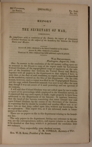
1852 WCB 212 Graham, James D[uncan] (1799-04-04 – 1865-12-28); 32d CONGRESS, | 1st Session. [SENATE.] Ex. Doc. | No. 121. [rule] REPORT | OF | THE SECRETARY OF WAR, | COMMUNICATING, | In compliance with a resolution of the Senate, the report of Lieutenant |Colonel Graham on the subject of the boundary line between the United | States and Mexico. [rule] AUGUST 27, 1852—Referred to the Select Committee on the subject. … Ordered that 2,000 additional copies be printed., Washington, first edition, 250 pp., octavo, 22.5 x 14 cm., two folding maps and a folding profile. [Eberstadt 113; Graff 1609; Howes G286; Jenkins BTB p. 151; Meisel III, p. 100; WCB 212; Wheat, MTW 717, 718; Raines p. 96]. Original brown blind stamped cloth with gilt title on front cover, spine faded, fine. $450.
Jenkins calls this “one of the most detailed” documents relating to the Mexican Boundary. “In addition to reporting his troubles with John R. Bartlett, Graham included information and reports on southern New Mexico and Lt. Amiel Whipple’s reports on the survey of the Gila River.” Wagner-Camp. “Col. G. was principal astronomer and head of the scientific corps under Commissioner Jno. R. Bartlett in Texas and Mexico.”

1852 WCB 216a Bartlett, John Russell (1805/10/23 – 1886/5/28); 32d CONGRESS, | 1st Session. [SENATE.] Ex. Doc. | No. 119. [rule] REPORT | OF THE | SECRETARY OF THE INTERIOR, | MADE IN COMPLIANCE WITH | A resolution of the Senate calling for information in relation to the com- | mission appointed to run and mark the boundary between the United | States and Mexico. [rule] JULY 26, 1852.—Referred to a Select Committee on the subject. | AUGUST 31, 1852.— Ordered to be printed., Washington, first edition, 515 pp., octavo, 22 x 13.5 cm., [Howes B200. WCB 216a, the 7 folding maps are MTW 703, 704, 705, 706, 712 717, 718,] In Executive Documents set. Ex library, with ink stamp on title page and elsewhere. Old calf with both covers detached, internally good. $250.

1852 WCB 219:2 Stansbury, Howard (1806/2/8 – 1863/4/17). SPECIAL SESSION, | March, 1851. Senate. EXECUTIVE. | No. 3. [rule] EXPLORATION AND SURVEY | OF THE | VALLEY | OF THE | GREAT SALT LAKE OF UTAH, | INCLUDING | A RECONNOISSANCE OF A NEW ROUTE THROUGH | THE ROCKY MOUNTAINS. | BY HOWARD STANSBURY, | CAPTAIN CORPS TOPOGRAPHICAL ENGINEERS, | U. S. ARMY. | PRINTED BY ORDER OF THE SENATE OF THE UNITED STATES. | PHILADELPHIA: | LIPPINCOTT, GRAMBO & CO. | 1852., Second issue of first edition, 487 pp., octavo, 22.5 x 14 cm., 34 lightly tinted lithographs 3 folding, 23 black and white plates, [Howes S884; WCB 219:2; Graff 3947; Field 1940; Goetzmann, p. 468; Sabin 90372; Meisel III, p. 115; MTW 764 and 765;]. Also separate atlas containing two very large maps, 111 x 76 and 72 x 172.5 cm. Original brown blind stamped cloth for both text and atlas which are the same octavo size. Text volume faded, atlas volume, fine. $1,750.
An extensive survey of the Great Basin and a major landmark in the cartography of the American West. In 1846 Stansbury received the orders for the cornerstone of his career: the expedition to the Great Salt Lake in 1849-1850. On 31 May 1849 he left Fort Leavenworth with eighteen men, including Lieutenant John W. Gunnison, artist John Hudson, and Albert Carrington, a leading Mormon official. The company proceeded by way of South Pass in Wyoming to Fort Bridger, where Stansbury engaged Jim Bridger as a guide for the expedition. Dividing his men into two groups, Stansbury explored a new route to the Great Salt Lake by following a path between the Bear River and Echo Canyon trails. The expedition members spent the winter of 1849-1850 in Salt Lake City as guests of the Mormon population there. This, the most intricate part of Stansbury’s mission, required diplomacy and tact. Since the Mormon state of Deseret (meaning “honeybee”) was the only legally incorporated civil government in that area from 2 July 1849 through 5 February 1851, Stansbury and his men were to some extent visiting a foreign country. Stansbury managed to placate Mormon leader Brigham Young. Stansbury’s later recollections of the Mormon leader and of his people are noteworthy, since they showed some objectivity toward the Mormons. On Brigham Young himself, Stansbury wrote, “his personal reputation I believe to be above reproach” (Stansbury, p. 147). On the matter of polygamy, Stansbury asserted that “its practical operation was quite different from what I had anticipated. Peace, harmony, and cheerfulness seemed to prevail. . . . Confidence and sisterly affection among the different members of the family seemed pre-eminently conspicuous” (Stansbury, pp. 137-38). Stansbury went on to praise the ingenuity and resourcefulness of the Mormon people, while allowing that their beliefs would preclude them from living with any other Christian peoples without “constant collision, jealousy, and strife” (Stansbury, p. 138). In the spring of 1850 Stansbury and his party of explorers made a complete circumnavigation of Great Salt Lake and surveyed the area. On their return journey, Stansbury sought to pioneer a new route that would go due east from Salt Lake City through the Wasatch Mountains. Stansbury located what became known as Cheyenne Pass and Bridger Pass; his return route would later be used by the Overland Stage and the Union Pacific Railroad. On 6 October 1850, as his exploration neared its end, Stansbury suffered an injury; he was brought by an ambulance to Fort Laramie, where he arrived on 12 October, concluding what had been a significant venture into the Great Basin area and the newly created land of the Mormon people. Stansbury spent the next year and a half in Washington, D.C., where he wrote his classic report on the expedition. The report brought both praise and denunciation; Stansbury’s elegant prose did not prevent critics from attacking his fair-minded observations of the Mormon settlements. The tinted plates show the landscape of this area for the first time. The uncolored plates show primarily wildlife and plants.


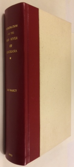
1853 WCB 226:1 Marcy, Randolph B[arnes] (1812/4/9 – 1887/11/22); George B[rinton] McClellan (1826/12/3 – 1885/10/29); 32d CONGRESS, | 2d Session. SENATE. EXECUTIVE, | No. 54. [rule] EXPLORATION | OF THE | RED RIVER OF LOUISIANA, | IN THE YEAR 1852: | BY | RANDOLPH B. MARCY, | CAPTAIN FIFTH INFANTRY U. S. ARMY; | ASSISTED BY GEORGE B. McCLELLAN, | BREVET CAPTAIN U. S. ENGINEERS. [rule] WITH REPORTS ON THE NATURAL HISTORY OF THE COUNTRY, | AND NUMEROUS ILLUSTRATIONS. [rule] WASHINGTON: | ROBERT ARMSTRONG, PUBLIC PRINTER. | 1853., first edition, xv, 320 pp., octavo 22.5 x 13.5 cm., 65 plates on unnumbered leaves some folding. Two large folding maps in pocket on back flap, [Howes M 276; WCB 226:1; Graff 2675; Meisel III, p. 143; Rader 2346; Goetzmann p. 213; Pilling 2471; Sabin 44512] [The two large folding maps are MTW 791, 792]. Rebound in white cloth with quarter red morocco and gilt lettering, fine. $900.
There are numerous lithographed plates (some tinted) of views, botany, zoology, paleontology, geology, and geography executed by Ackerman. “Written by one of the greatest nineteenth-century American explorers, this is one of the most interesting accounts of an original exploration of unknown parts of Texas [Marcy] was the first Anglo-American to discover and explore Palo Duro Canyon and Tule Canyon. Marcy described in detail the little-known Wichita tribe and compiled the first Wichita dictionary” (Jenkins, ‘Basic Texas Books’ 135B). “[Marcy’s] large map was an attempt not only to bring together information obtained from his own explorations, but to show the relation of that country to the areas lying to the north, south and west, as far as the Colorado River of the West. Marcy’s map is one of the best of the period. No southern emigrant could afford to be without it” (TMW #791 & #792, Vol. III, pp. 15-16). Captain Marcy, “a veteran of the Mexican War who had made an 1849 reconnaissance from Fort Smith to Santa Fe, argued that the Red River, formerly an international frontier and now the boundary between Texas and Indian Territory, was too important for its source to remain unknown to the government. The War Department agreed and designated him to “collect and report everything that may be useful or interesting in relation to [the region’s] resources, soil, climate, natural history, and geography.” The Adjutant General also ordered him to remind any Indians that he encountered of the military power of the United States and the certainty of punishment if they continued to resist Anglo immigration and to determine whether the area could sustain a large Indian population and, if so, could they be induced to settle down and take up farming. He undertook the survey, noting that it was “remarkable that a portion of one of the largest and most important rivers in the United States remained up to that period wholly unexplored and unknown a ‘terra incognita.‘ ” “While Marcy was ultimately unsuccessful in finding the true headwaters of the Red, he did accomplish some of his other goals and, in the process, provided the first lithographic documentation of the unexplored and dramatic Palo Duro Canyon, in fact the first of the great southwestern canyons to be documented and published for a popular audience” (Dr. Ron Tyler reported by Dorothy Sloan).


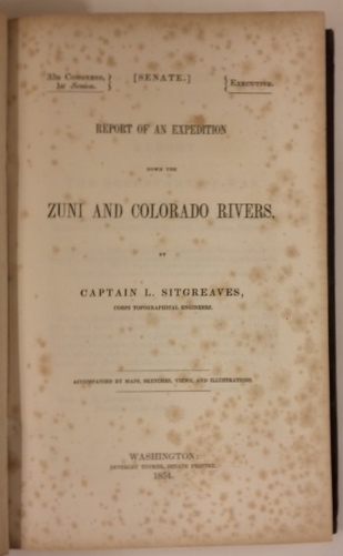
1853 WCB 230:1 Sitgreaves, Lorenzo (1810/2/15 – 1888/5/14); 32d CONGRESS, | 2d Session. SENATE. EXECUTIVE, | No. 59. [rule] REPORT OF AN EXPEDITION | DOWN THE | ZUNI AND COLORADO RIVERS, | BY | CAPTAIN L. SITGREAVES, | CORPS TOPOGRAPHICAL ENGINEERS. [rule] ACCOMPANIED BY MAPS, SKETCHES, VIEWS, AND ILLUSTRATIONS. [rule] WASHINGTON: | ROBERT ARMSTRONG, PUBLIC PRINTER. | 1853., first edition, 198 pp., octavo, 22 x 13 cm., 79 plates and large folding map, [Field 1414; Howes S521; WCB 230:1; Graff 3809; Meisel III, p. 134; Sabin 81472; large folding map is MTW 763], Substantial foxing. Original blind stamped brown cloth, lower ends of back strip frayed, corners bumped,. Very good, $1,200.


1853 WCB 235 Heap, Gwinn Harris (1817/3/23 – 1887); CENTRAL ROUTE | TO THE | PACIFIC, | FROM THE | VALLEY OF THE MISSISSIPPI TO CALIFORNIA: | JOURNAL OF THE EXPEDITION | OF | E. F. BEALE, SUPERINTENDENT OF INDIAN AFFAIRS IN | CALIFORNIA, AND GWINN HARRIS HEAP, | FROM | MISSOURI TO CALIFORNIA, IN 1853. | BY | GWINN HARRIS HEAP. | PHILADELPHIA: | LIPPINCOTT, GRAMBO, AND CO. | 1854., first edition, 136 pp., 46 pages of book advertisements, octavo 22 x 14 cm., colored frontispiece with tissue guard and 12 other plates, some tinted, [Cowan p. 273; Graff 1837; Howes H378; Sabin 31175; MTW 808; WCB 235, Streeter V 3177]. Attractively rebound. Folding map (MTW 808) missing as is almost always the case. Water staining to the upper outer corner of first four pages including the frontispiece, but apparently stopped by the tissue guard. Very good. $850.
In March of 1853, E. F. Beale, the Superintendent of Indian Affairs for the State of California succeeded in obtaining $250,000 from Congress for the “better protection, subsistence, and colonization of the Indian tribes within his superintendency” (Introduction). To this end he and Heap proceeded by the shortest route to Los Angeles, California, to select the land most suitable for Indian reservations and along the way made observations of many unexplored areas through New Mexico and Utah. The volume also includes the earliest published account of Death Valley. “[O]f all the journals and diaries telling of the Mojave desert crossing, none appears comparable to Heap in sheer readability and in picturesque descriptive quality” (Edward, “Enduring Desert”, pp. 110-11).


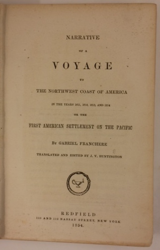
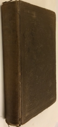
1854 WCB 16:2 Franchere, Gabriel (1786/11/3 – 1863/4/12); NARRATIVE | OF A | VOYAGE | TO | THE NORTHWEST COAST OF AMERICA | IN THE YEARS 1811, 1812, 1813, AND 1814 | OR THE | FIRST AMERICAN SETTLEMENT ON THE PACIFIC | BY GABRIEL FRANCHERE | TRANSLATED AND EDITED BY J. V. HUNTINGTON [device] REDFIELD | 110 AND 112 NASSAU STREET, NEW YORK | 1854., second edition but first in English, 376, [8] pp., duodecimo 18.5 x 12 cm., three full page plates still protected by untorn tissue guards, [Graff 1400; Howes F310; WCB 16:2; Streeter 3718; Monaghan 706; Peel 70n; Pilling 1323n; Sabin 25432; Strathern 194i]. Original brown blind stamped cloth, spine faded, corners bumped, head and tail of spine show abrasion. Previous owner’s name on front free end paper dated 1876 in the Dalles, Oregon. Her corrections to text written in both pencil and ink. Most likely this owner pasted a newspaper clipping about Dr. William McKay on the rear free end paper. (He was the grandson of both Alexander McKay of the Astorians and of Chief Cumcumally of the Chinook and Chehalis Indians.) Over all, very good. $1,500.
First English translation of Gabriel Franchere’s account of Astoria on the mouth of the Columbia River. While the book chiefly recounts his extraordinary overland journey of five months through the Rocky Mountains to the Red River Settlement (later Winnipeg) and thence to Montreal, it is also well-regarded for the author’s account of his early and important visits to Hawaii and Tahiti en route to the Pacific Northwest. Franchere’s narrative was first published in Montreal in 1820 in French; this edition was prepared for the American public by the clergyman and sometime novelist Jebediah Vincent Huntington, who patriotically proclaims the book as “the only account by an eye witness and a participator in the enterprise, of the first attempt to form a settlement on the Pacific under the Stars and Stripes.” Franchere was a member of the party sent out by John Jacob Astor on the vessel Tonquin to found a fur trading post at Astoria, at the mouth of the Columbia River. The account of his three-year stay, his inland travels, the transfer of Astor’s company to the North West Fur Company of Canada in 1813 and subsequent actions of the British, forms a detailed and important document in Canadian history. Additionally, the outbound journey of the Tonquin is included, in which Franchere gives a good account of the customs and political situation of the Hawaiian islands as well as a biography of Kamehameha I. The work is referred to in the text as the “second edition”, which is slightly misleading since the earlier edition was in French.

1854 WCB 226:3 Marcy, Randolph B[arnes] (1812/4/9 – 1887/11/22); George B[rinton] McClellan (1826/12/3 – 1885/10/29); 33d CONGRESS, | 1st Session. HO. OF REPS. EXECUTIVE | Doc. [rule] EXPLORATION | OF THE | RED RIVER OF LOUISIANA, | IN THE YEAR 1852: | BY | RANDOLPH B. MARCY, | CAPTAIN FIFTH INFANTRY U. S. ARMY; | ASSISTED BY | GEORGE B. McCLELAN, | BREVET CAPTAIN U. S. ENGINEERS. [rule] WITH REPORTS ON THE NATURAL HISTORY OF THE COUNTRY, | AND NUMEROUS ILLUSTRATIONS. [rule] WASHINGTON: | A. O. P. NICHOLSON, PUBLIC PRINTER. | 1854., Third issue of first edition, xv, 320 pp., 22.5 x 14 cm., 65 plates on unnumbered leaves some folding, separate atlas with two large folding maps. [Goetzmann p. 213; Howes M276; WCB 226:3; Graff 2675; Meisel III p. 144; Rader 2346n; Sabin 44512; the two large folding maps are MTW 791, 792] Maps 69 x 150 and 41 x 86 cm.
Small water stain on top of a few pages in back. Original brown blind stamped cloth, corners of text volume bumped. Spine of atlas detaching on one side. Very good. $800.

1854 WCB230:2 Sitgreaves, Lorenzo (1810/2/15 – 1888/5/14); 33D CONGRESS, | 1st Session. [SENATE.] EXECUTIVE. [rule] REPORT OF AN EXPEDITION | DOWN THE | ZUNI AND COLORADO RIVERS, | BY | CAPTAIN L. SITGREAVES, | CORPS TOPOGRAPHICAL ENGINEERS. [rule] ACCOMPANIED BY MAPS, SKETCHES, VIEWS, AND ILLUSTRATIONS. [rule] WASHINGTON: | BEVERLEY TUCKER, SENATE PRINTER. | 1854., second issue of first edition, 198 pp., octavo, 24 x 16 cm., 79 plates and large folding map, [Field 1414; Howes S521; WCB 230:2; Graff 3809,; Meisel III, p.134; large folding map is MTW 763]. Original blind stamped brown cloth, lower end of back strip frayed, corners bumped, foxed. Very good, $1,050.

1854 WCB 234:1 Bartlett, John Russell (1805/10/23 – 1886/5/28). PERSONAL NARRATIVE | OF | EXPLORATIONS AND INCIDENTS | IN | TEXAS, NEW MEXICO, CALIFORNIA, SONORA, | AND CHIHUAHUA, | CONNECTED WITH | THE UNITED STATES AND MEXICAN BOUNDARY COMMISSION, | DURING THE YEARS 1850, ’51, ’52, AND ’53. | BY | JOHN RUSSELL BARTLETT, | UNITED STATES COMMISSIONER DURING THAT PERIOD. | IN TWO VOLUMES, WITH MAP AND ILLUSTRATIONS. | VOL. [I. / II.] | NEW YORK: | D. APPLETON & COMPANY, 346 & 348 BROADWAY, | AND 16 LITTLE BRITAIN, LONDON. | M.DCCC.LIV., first issue of first edition, Two Volumes, xxii, 506; xvii, 624 pp., octavo 22 x 13.5 cm., 2 folding frontispieces, 14 lithographed plates with tissue guards, text illustrations, huge folding map [WCB 234:3; Graff 198; Howes B 201; Sabin 3746; Cowan (1933) p. 36; Flake 325; Jenkins 12, Meisel III p. 100; Rader 287, Raines, p. 22], Original half calf and marbled boards, end papers and all edges with matching marbling, both title pages have offsetting from folding frontispieces. Fine. $3,500.
A cornerstone work of Southwestern travel and exploration. The expedition left Indianola in September 1850 and spent nearly three years travelling throughout the region in an effort to determine the border between the United States and Mexico, which had been left indefinite by the Treaty of Guadalupe Hidalgo after the Mexican War. The resultant work remains one of the most readable and accurate accounts of the American Southwest for the period, and the illustrative matter includes some of the most competent depictions of the area. “Bartlett’s Narrative is an essential book for the southwest.” Graff. The large folding map shows the region in detail. Bartlett later became the first librarian of the John Carter Brown Library.


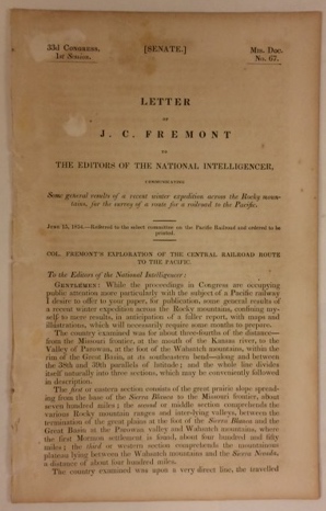
1854 WCB 239:1 Fremont, J[ohn] C[harles] (1813/1/21 – 1890/7/13); 33d CONGRESS, | 1st Session. [SENATE.] Mis. Doc. | No. 67. [rule] LETTER | OF | J. C. FREMONT | TO THE EDITORS OF THE NATIONAL INTELLIGENCER, | COMMUNICATING | Some general results of a recent winter expedition across the Rocky moun- | tains, for the survey of a route for a railroad to the Pacific. [rule] June 15, 1854.—Referred to the select committee on the Pacific Railroad and ordered to be printed., first edition, 7 pp., octavo, 23 x 14 cm., [WCB 239:1, Graff 1430]. Disbound, foxed and darkened. Good +. $175.
“The route that Fremont recommends follows his 1848 expedition as far as the San Luis Valley in Colorado, then up the Sahwatch River and over the ‘Coochatope’ Pass to the Colorado River, over the ‘Wahsatch’ Mountains to Parowan and Cedar City, then west to the Sierra Nevada. Three of Fremont’s letters were printed in the National Intelligencer in the spring of 1854, of which the above was the third, appearing on June 14.”
1854 WCB239e Johnson, Edwin F. (1803/5/23 – 1872/12). RAILROAD TO THE PACIFIC. | NORTHERN ROUTE. [rule] ITS GENERAL CHARACTER, | RELATIVE MERITS, ETC. | PY (sic) EDWIN F. JOHNSON, C. E. | SECOND EDITION. [rule] NEW YORK: | RAILROAD JOURNAL JOB PRINTING OFFICE, 122 NASSAU STREET. | 1854., Although noted as second edition on the title page it is really the first edition., iv, 5-[176] pp., octavo, 23 x 14.5 cm., 7 plates, 3 maps, 2 folding maps, 1 folding profile, [Howes J133, WCB 239e, Graff 2216; Sabin 36207; Wheat Gold Regions 240], Tan printed wrappers, but spine missing. Inscription on front wrapper “Prof. Henry with compts of author.” (Joseph Henry (1797/12/17–1878/5/13), First Secretary of the Smithsonian Institution, 1846-1878.) Very good. $1,750.
The final page 176 is mis-numbered 166. Styled the second edition on the title page, but actually the first printing in book form, sections having appeared previously only in periodicals. The author was a fine engineer and ultimately the chief of engineering for the construction of the Northern Pacific. Herein he summarizes the route later followed by the line, one of the most elaborate works issued before the Railroad Surveys. There is much information on the terrain of the proposed route, the findings of earlier explorers, climate, soil, etc. Projected railroad routes are shown on the maps, with possible routes outlined. “This is in many ways an extraordinary map. It has the routes of Lewis and Clark, Fremont and Emory well drawn, and its showing of the general features of the topography is also excellent, considering the time of its preparation”, TMW.

Wheat, Carl I[rving] (1892/12/05-1966/06/23); 1540-1861 | MAPPING | the Transmississippi | WEST | By Carl I Wheat | Volume [One/Two… Five, Part II] [[Separate description of contenet for each volume]] [flourish] San Francisco | The Institute of Historical Cartography [1957/…/1963], first edition, 5 volumes bound as 6, xiii, 264; xiii, 281; xiii, 349; xiii, 260; xviii, 222; 223-487 pp., folio 37 x 27 cm. The work discusses 1,302 maps of which 374 are reproduced., limited to 1,000 copies designed by Edwin and Robert Grabhorn. [Grabhorn Bibliography 590, Volume I only], The first volume was printed by the Grabhorn Press, the rest by Taylor & Taylor & James,
Considered by many to be the finest publication of a cartographic and bibliographic work. Printed on high quality deckle-edge paper. The set is beautifully bound in 2-color buckram with gilt lettering on the spines. This beautifully printed account of the mapping of America’s Transmississippi West traces the story of American cartography and exploration, beginning with the Spanish Entrada in 1540 through the government surveys to the Geological Survey. Wheat traces the paths of the Spanish, French and English explorers and analyzes the resulting growth of knowledge through the succession of their maps. This series is an essential tool for any serious collector or scholar of Western Americana. It is unlikely to be superseded. (The reprint edition lacks the large folding map reproductions and the beautiful production qualities of the original.)
Additional copies for sale: Fine. Original plain brown paper dust jackets present. To accompany this set the following book is included: Charles A. Seavey, Mapping the Transmississippi West, 1540-1861: An Index to the Cartobibliography, Winnetka, Illinois, Speculum Orbis Press, 1992, vii, 210 pp., octavo 23 x 15 cm., new, bound in blue cloth. $3,500.
I shall refer to this set as MTW and Wagner-Camp-Becker as WCB.
[[Clearly I have not figured out how to put my hand-held iPhone pictures into the text!]]
1854 WCB 16:2 Franchere, Gabriel (1786/11/3 – 1863/4/12); NARRATIVE | OF A | VOYAGE | TO | THE NORTHWEST COAST OF AMERICA | IN THE YEARS 1811, 1812, 1813, AND 1814 | OR THE | FIRST AMERICAN SETTLEMENT ON THE PACIFIC | BY GABRIEL FRANCHERE | TRANSLATED AND EDITED BY J. V. HUNTINGTON [device] REDFIELD | 110 AND 112 NASSAU STREET, NEW YORK | 1854., second edition but first in English, 376, [8] pp., duodecimo 18.5 x 12 cm., three full page plates still protected by untorn tissue guards, [Graff 1400; Howes F310; WCB 16:2; Streeter 3718; Monaghan 706; Peel 70n; Pilling 1323n; Sabin 25432; Strathern 194i]. Original brown blind stamped cloth, spine faded, corners bumped, head and tail of spine show abrasion. Previous owner’s name on front free end paper dated 1876 in the Dalles, Oregon. Her corrections to text written in both pencil and ink. Most likely this owner pasted a newspaper clipping about Dr. William McKay on the rear free end paper. (He was the grandson of both Alexander McKay of the Astorians and of Chief Cumcumally of the Chinook and Chehalis Indians.) Over all, very good. $1,500.
First English translation of Gabriel Franchere’s account of Astoria on the mouth of the Columbia River. While the book chiefly recounts his extraordinary overland journey of five months through the Rocky Mountains to the Red River Settlement (later Winnipeg) and thence to Montreal, it is also well-regarded for the author’s account of his early and important visits to Hawaii and Tahiti en route to the Pacific Northwest. Franchere’s narrative was first published in Montreal in 1820 in French; this edition was prepared for the American public by the clergyman and sometime novelist Jebediah Vincent Huntington, who patriotically proclaims the book as “the only account by an eye witness and a participator in the enterprise, of the first attempt to form a settlement on the Pacific under the Stars and Stripes.” Franchere was a member of the party sent out by John Jacob Astor on the vessel Tonquin to found a fur trading post at Astoria, at the mouth of the Columbia River. The account of his three-year stay, his inland travels, the transfer of Astor’s company to the North West Fur Company of Canada in 1813 and subsequent actions of the British, forms a detailed and important document in Canadian history. Additionally, the outbound journey of the Tonquin is included, in which Franchere gives a good account of the customs and political situation of the Hawaiian islands as well as a biography of Kamehameha I. The work is referred to in the text as the “second edition”, which is slightly misleading since the earlier edition was in French.
Photos not currently available.
1850 WCB 179b:2 [Taylor, Z[ackery]] (1784/11/4 – 1850/7/9); 31st CONGRESS, | 1st Session. [HO. OF REPS.] EX. DOC. | No. 17. [rule] CALIFORNIA AND NEW MEXICO. [rule] MESSAGE | FROM | THE PRESIDENT OF THE UNITED STATES, | TRANSMITTING | Information in answer to a resolution of the House of the 31st of De- | cember, 1849, on the subject of California and New Mexico. [rule] JANUARY 24, 1850. |…| FEBRUARY 6, 1850. | Ordered, That 10,000 copies extra be printed., Washington, House issue of first edition. 977 pp., octavo 22.5 x 13.5 cm., 7 maps, 6 folding, [Cowan p. 40, Howell, Catalogue 50, no. 230, Howes C53 and (incorrectly) P447, Kurutz, Gold Rush 106, WCB 179b:2, Wheat Gold Rush 31, Zamorano Eighty 14, Sotheby’s New York “Magnificent American, Historical Documents”, 10th May 2011, lot 1059, maps are MTW 613, 571]. Original sheep-backed marbled boards; the spine has been shellacked long ago to slow deterioration, but bits have chipped off, corners bumped. Light foxing and offsetting throughout but complete with 7 maps (6 folding). Early owner’s name boldly written on front free endpaper. Otherwise, very good and sound. $1,700.
Particularly interesting maps of San Francisco and the California Mining District. Cowan calls this volume “the most extensive source book of authorities covering the period 1847-50. Besides the conduct of the Mexican War in California, it covers such significant events as the formation of the provisional military government and the transition from territory to statehood. So great was its popularity that Congress ordered 10,000 extra copies to be printed. Among the maps are Derby’s chart of the route of General Riley through the mining districts in 1849, Fremont’s surveys, military maps of Fort Hall, Monterey, and the Presidio of San Francisco, and Beale’s expedition against the Indians. There are also two maps of lower California”. Zamorano says: “This thick government compendium contains a wealth of information on the annexation of Alta California by the United States, the changeover from Mexican to American rule, the transition from military to civilian government and the earliest days of the Gold Rush. It systematically documents the work of the federal government in the newly won territory from 1847 to 1849.” “Arguably, these were the most important years in California history and no single publication provides as much raw data as does House Executive Document No. 17. It opens with a brief statement by Mexican-American War hero President Zachary Taylor, which touches on California’s desire to be admitted to the Union as a state. The federal publication then proceeds with a plethora of official proclamations, reports, circulars and letters from virtually every important American official in California including Washington Bartlett, Walter Colton, R. B. Mason, Bennet Riley, Jonathan Drake Stevenson, Joseph Folsom, Stephen Watts Kearny, William Tecumseh Sherman, John C. Fremont, Henry W. Halleck, and E. R. S. Canby”. (Kurutz, Volkmann).


1850 WCB 181:3 Cross, O[sborn] (1803 to 1876-07-15); A report, in the form of a journal, to the Quartermaster General, of the | march of the regiment of mounted riflemen to Oregon, from May 10 | to October 5, 1849, by Major O. Cross, quartermaster United States | army. Washington, 1850, third issue of first public edition, In: Message from the President of the United States to the two Houses of Congress at the commencement of the Second Session of the thirty-first Congress. 126 – 244 pp, 36 plates with 3 folding, octavo 22 x 14 cm. [WCB 181:3; Graff 4415; Howes C923; Sabin 17660], One folding plate torn, heavily foxed. Rebound in modern black buckram with gilt lettering on spine. $1,000.
Complete with all 36 lithographed plates, 3 of them folding. The lithographs were done by Ackerman in N. Y. and Weber in Baltimore. One of the very earliest descriptions of the Northwest. Detailed description of the Emigrant Trail to Oregon, amply illustrated with scenes along the way. The troops were moving west to the new military posts on the Pacific Coast. This official edition was preceded by a Philadelphia edition in 1850 of which only a few copies were made for the author. “This report is a mine of information, not only about the army’s advance to garrison posts along the Oregon Trail, but also about the concurrent pageantry of the California gold rush” – Mattes 415. “Major Cross’s report presents a detailed description of the emigrant trail to Oregon with views of scenes along the route from Fort Laramie to The Dalles.” (WCB 181:3). This report is historically important, and the marvelous plates are among the earliest of the Oregon Trail. Caption title is on the verso of the first page (126). Army records show his first name spelled Osborne.


Fort Laramie
Snake River Falls
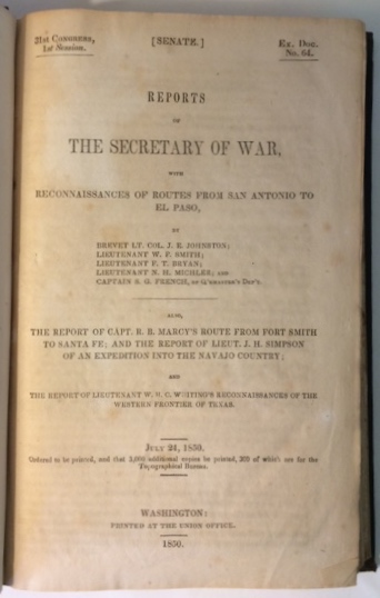
1850 WCB 184 Johnston, J[oseph] E[ccleston] (1807/2/3 – 1891/3/21); W[illiam] F[arrar] Smith (1824/2/17 – 1903/2/28) ; F[rancis] T[heodore] Bryan, (1823/4/11 – 1917/10/24); N[athaniel] H. Michler (1827/9/13 – 1881/7/17); S. G. French; R[andolph] B[arnes] Marcy, (1812/4/9 – 1887/11/22); J[ames] H[ervey] Simpson, (1813/3/9 – 1883/3/2); W[illiam] H[enry] C[hase] Whiting (1824/3/22 – 1865/3/10); 31st CONGRESS, | 1st Session. [SENATE.] Ex. Doc. | No. 64. [rule] REPORTS | OF | THE SECRETARY OF WAR, | WITH | RECONNAISSANCES OF ROUTES FROM SAN ANTONIO TO | EL PASO, | BY | BREVET LT. COL. J. E. JOHNSTON; | LIEUTENANT W. F. SMITH; | LIEUTENANT F. T. BRYAN; | LIEUTENANT N. H. MICHLER; AND | CAPTAIN S. G. FRENCH, OF Q’RMASTER’S DEP’T. [rule] ALSO, | THE REPORT OF CAPT. R. B. MARCY’S ROUTE FROM FORT SMITH | TO SANTA FE; AND THE REPORT OF LIEUT. J. H. SIMPSON | OF AN EXPEDITION INTO THE NAVAJO COUNTRY; | AND | THE REPORT OF LIEUTENANT W. H. C. WHITING’S RECONNAISSANCES OF THE | WESTERN FRONTIER OF TEXAS. [rule] JULY 24, 1850. | Ordered to be printed, and that 3,000 additional copies be printed, 300 of which are for the | Topographical Bureau. [rule] WASHINGTON: | PRINTED AT THE UNION OFFICE. [rule] 1850., First edition, 250 pp., octavo 23 x 15 cm., two folding maps, 72 plates (some colored), [Howes J170, WCB 184, Graff 2228; Meisel III, p. 113; Sabin 36377; MTW 641, 677]. Original brown embossed cloth. Top and bottom of spine frayed, corners bumped, light offsetting of text, but plates and maps are fine, over all very good+. $2000.
This volume contains reports by W.F. Smith, F.T. Bryan, N.H. Michler, S.G. French, R.B. Marcy and W. H. C. Whiting, in addition to the supremely important Navajo country report of J. H. Simpson. It is possibly the first book issued in America with color lithography. The colors are as bright as the day they were printed.


1850 WCB 192 Simpson, [James Hervey] (1813/3/9 – 1883/3/2); 31st CONGRESS, | 1st Session. [SENATE.] Ex. Doc. | No. 12. [rule] REPORT | FROM | THE SECRETARY OF WAR, | COMMUNICATING, | In compliance with a resolution of the Senate, the report and map of the | route from Fort Smith, Arkansas, to Santa Fe, New Mexico, made by | Lieutenant Simpson. [rule] JANUARY 14, 1850. | Ordered to be printed, and that 2,500 additional copies be printed, 500 of which are for the Topo- | graphical Bureau., Washington, 1850, 25 pp., four large folding maps, octavo 21.5 x 13.5 cm. [Howes S500; WCB 192; Graff 3790; Meisel III, p. 113; MTW 640]. Attractively bound in brown quarter morocco with gilt lettering and brown cloth. Fine. $1,100.


1850 WCB 192(note, including WCB 184) Simpson, [James Hervey] (1813/3/9 – 1883/3/2); R[andolph] B[arnes] Marcy (1812/4/9 – 1887/11/22); 31st CONGRESS, | 1st Session. [HO. OF REPS.] Ex. Doc. | No. 45. [rule] ROUTE FROM FORT SMITH TO SANTA FE. [rule] LETTER | FROM | THE SECRETARY OF WAR, | TRANSMITTING, | In compliance with a resolution of the House of the 6th February, a report |and map of Lieutenant Simpson, of the route from Fort Smith to Santa |Fe; also, a report on the same subject from Captain R. B. Marcy, | 5th infantry. [rule] FEBRUARY 21, 1850., Washington, 89 pp. , octavo 21.5 x 13.5 cm. one large folding map, two plates, [Howes S500; WCB 192 (note); Graff 3790; Meisel III, p. 113; MTW 640]. Beautifully rebound in green quarter morocco with gilt lettering and brown buckram. Fine. $900.


I will now post some of the hundreds of books I own listed in this important bibliography. In order to postpone listing my most valuable books I will start with 1850.
Wagner, Henry R[aup] (1862/9/27 – 1957/3/28) Charles L[ewis] Camp (1893/3/12 – 1975/8/14); Robert H. Becker (unknown dates); HENRY R. WAGNER & CHARLES L CAMP | The Plains | & | the Rockies: | A CRITICAL BIBLIOGRAPHY OF EXPLORATION, | ADVENTURE AND TRAVEL IN THE AMERICAN WEST | 1800-1865. | FOURTH EDITION | Revised, Enlarged and Edited by | ROBERT H. BECKER | San Francisco | JOHN HOWELL-BOOKS | 1982, ISBN: 0-910760-11-1, xx, 745 pp. , octavo, 26 x 17 cm., 33 illustrations, colophon.
Printed at the Arion Press with two color title page. This revision of the premier reference book of Western Americana gives thorough bibliographic treatment of each known issue and edition of each title, with line-by-line transcriptions of every title page and every map, full collations, references and confirmed locations of copies, together with brief editorial comments, and an index of authors, titles and subjects. (Since this bibliography notes all blank pages, I will not do so.)
(Additional new copies in original maroon cloth for sale at $150.00)
Imago Mundi, Journal of History of Cartography; Volume I (1935) to Volume 57, Part 2 (2005). All original editions except Volume XIII which is the 1965 reprint. All very good to fine.

Vol. I (1935, Berlin); Vol. II (1937, London); Vol. III (1939, London); Vol IV.(1947) through XIII (1957), Stockholm); Volume XIV and XV Mouton & Co., ‘S-Gravenhage; Volume I to Volume XV edited by Leo Bagrow. Volume XVI (1962) to XXVI (1972) Nico Israel, Amsterdam; Volume XXVII (1975) to XXXV Lympne Castle; XXXVI (1984) to LVII, Part 2 (2005) London. Volumes I to XXVI cream stiff printed paper wrappers. Volume XXVII to Blue paper covered boards with gilt lettering and decorations, Volumes to LVII, part 2 blue printed stiff paper wrappers. Most issues well over 150 pages heavily illustrated often with folding maps and illustrations, all 29 x 20.5 cm.
This is the premier publication on the history of cartography with important articles and other information in each issue. Complete runs of any length are extremely rare. $5,000.
The Quarterly of the Oregon Historical Society / Oregon Historical Quarterly; Almost complete run from Volume I, Number 1, 1900 to present. Lacking only Volume III, Number 1 and Volume VII, Numbers 2 and 3. All in very good or better condition. None bound, each issue in its original wrappers. Vol I, 1 to XLVIII,3 24 x 15.5 cm.; Vol XLVIII, 4 to CII, 4 23 x 14.5 cm.; Vol. CIII, 1 to present 25.5 x 17 cm.; Vol. I, 1 to LXI, 4 and LXV, 1 to LXVI, 4 cream to tan printed stiff paper wrappers; Vol. LXII, 1 to LXIV, 4 red printed stiff paper wrappers; Vol. LXVII,1 to LXXXVII,4 and XC, 2/3 to present varicolored pictorial slick printed wrappers; Vol. LXXXVIII, 1 to XCIV, 1 Gray and white slick printed wrappers.
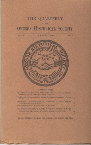
Contains numerous valuable illustrated articles on Oregon and neighboring regional history, biography, culture, politics, etc. $5,750.

Transactions of the Oregon Pioneer Association: Complete run except for the very last issue, 1928. Volumes 1875 through Volume 1909 in four volumes: 1875-1886 (both covers detached but binding sound), 1887-1893 (fine), 1894-1902 (not uniformly trimmed and top of spine damaged), 1903-1909 (not uniformly trimmed and scuffed), 1910-1911, 1912-1927 in original wrappers or individually neatly bound except for 1924 water damaged in original wrapper. The final (thin) 1928 volume not present. $2,800.
