
1850 Wagner-Camp-Becker Books
[[Clearly I have not figured out how to put my hand-held iPhone pictures into the text!]]
1854 WCB 16:2 Franchere, Gabriel (1786/11/3 – 1863/4/12); NARRATIVE | OF A | VOYAGE | TO | THE NORTHWEST COAST OF AMERICA | IN THE YEARS 1811, 1812, 1813, AND 1814 | OR THE | FIRST AMERICAN SETTLEMENT ON THE PACIFIC | BY GABRIEL FRANCHERE | TRANSLATED AND EDITED BY J. V. HUNTINGTON [device] REDFIELD | 110 AND 112 NASSAU STREET, NEW YORK | 1854., second edition but first in English, 376, [8] pp., duodecimo 18.5 x 12 cm., three full page plates still protected by untorn tissue guards, [Graff 1400; Howes F310; WCB 16:2; Streeter 3718; Monaghan 706; Peel 70n; Pilling 1323n; Sabin 25432; Strathern 194i]. Original brown blind stamped cloth, spine faded, corners bumped, head and tail of spine show abrasion. Previous owner’s name on front free end paper dated 1876 in the Dalles, Oregon. Her corrections to text written in both pencil and ink. Most likely this owner pasted a newspaper clipping about Dr. William McKay on the rear free end paper. (He was the grandson of both Alexander McKay of the Astorians and of Chief Cumcumally of the Chinook and Chehalis Indians.) Over all, very good. $1,500.
First English translation of Gabriel Franchere’s account of Astoria on the mouth of the Columbia River. While the book chiefly recounts his extraordinary overland journey of five months through the Rocky Mountains to the Red River Settlement (later Winnipeg) and thence to Montreal, it is also well-regarded for the author’s account of his early and important visits to Hawaii and Tahiti en route to the Pacific Northwest. Franchere’s narrative was first published in Montreal in 1820 in French; this edition was prepared for the American public by the clergyman and sometime novelist Jebediah Vincent Huntington, who patriotically proclaims the book as “the only account by an eye witness and a participator in the enterprise, of the first attempt to form a settlement on the Pacific under the Stars and Stripes.” Franchere was a member of the party sent out by John Jacob Astor on the vessel Tonquin to found a fur trading post at Astoria, at the mouth of the Columbia River. The account of his three-year stay, his inland travels, the transfer of Astor’s company to the North West Fur Company of Canada in 1813 and subsequent actions of the British, forms a detailed and important document in Canadian history. Additionally, the outbound journey of the Tonquin is included, in which Franchere gives a good account of the customs and political situation of the Hawaiian islands as well as a biography of Kamehameha I. The work is referred to in the text as the “second edition”, which is slightly misleading since the earlier edition was in French.
Photos not currently available.
1850 WCB 179b:2 [Taylor, Z[ackery]] (1784/11/4 – 1850/7/9); 31st CONGRESS, | 1st Session. [HO. OF REPS.] EX. DOC. | No. 17. [rule] CALIFORNIA AND NEW MEXICO. [rule] MESSAGE | FROM | THE PRESIDENT OF THE UNITED STATES, | TRANSMITTING | Information in answer to a resolution of the House of the 31st of De- | cember, 1849, on the subject of California and New Mexico. [rule] JANUARY 24, 1850. |…| FEBRUARY 6, 1850. | Ordered, That 10,000 copies extra be printed., Washington, House issue of first edition. 977 pp., octavo 22.5 x 13.5 cm., 7 maps, 6 folding, [Cowan p. 40, Howell, Catalogue 50, no. 230, Howes C53 and (incorrectly) P447, Kurutz, Gold Rush 106, WCB 179b:2, Wheat Gold Rush 31, Zamorano Eighty 14, Sotheby’s New York “Magnificent American, Historical Documents”, 10th May 2011, lot 1059, maps are MTW 613, 571]. Original sheep-backed marbled boards; the spine has been shellacked long ago to slow deterioration, but bits have chipped off, corners bumped. Light foxing and offsetting throughout but complete with 7 maps (6 folding). Early owner’s name boldly written on front free endpaper. Otherwise, very good and sound. $1,700.
Particularly interesting maps of San Francisco and the California Mining District. Cowan calls this volume “the most extensive source book of authorities covering the period 1847-50. Besides the conduct of the Mexican War in California, it covers such significant events as the formation of the provisional military government and the transition from territory to statehood. So great was its popularity that Congress ordered 10,000 extra copies to be printed. Among the maps are Derby’s chart of the route of General Riley through the mining districts in 1849, Fremont’s surveys, military maps of Fort Hall, Monterey, and the Presidio of San Francisco, and Beale’s expedition against the Indians. There are also two maps of lower California”. Zamorano says: “This thick government compendium contains a wealth of information on the annexation of Alta California by the United States, the changeover from Mexican to American rule, the transition from military to civilian government and the earliest days of the Gold Rush. It systematically documents the work of the federal government in the newly won territory from 1847 to 1849.” “Arguably, these were the most important years in California history and no single publication provides as much raw data as does House Executive Document No. 17. It opens with a brief statement by Mexican-American War hero President Zachary Taylor, which touches on California’s desire to be admitted to the Union as a state. The federal publication then proceeds with a plethora of official proclamations, reports, circulars and letters from virtually every important American official in California including Washington Bartlett, Walter Colton, R. B. Mason, Bennet Riley, Jonathan Drake Stevenson, Joseph Folsom, Stephen Watts Kearny, William Tecumseh Sherman, John C. Fremont, Henry W. Halleck, and E. R. S. Canby”. (Kurutz, Volkmann).


1850 WCB 181:3 Cross, O[sborn] (1803 to 1876-07-15); A report, in the form of a journal, to the Quartermaster General, of the | march of the regiment of mounted riflemen to Oregon, from May 10 | to October 5, 1849, by Major O. Cross, quartermaster United States | army. Washington, 1850, third issue of first public edition, In: Message from the President of the United States to the two Houses of Congress at the commencement of the Second Session of the thirty-first Congress. 126 – 244 pp, 36 plates with 3 folding, octavo 22 x 14 cm. [WCB 181:3; Graff 4415; Howes C923; Sabin 17660], One folding plate torn, heavily foxed. Rebound in modern black buckram with gilt lettering on spine. $1,000.
Complete with all 36 lithographed plates, 3 of them folding. The lithographs were done by Ackerman in N. Y. and Weber in Baltimore. One of the very earliest descriptions of the Northwest. Detailed description of the Emigrant Trail to Oregon, amply illustrated with scenes along the way. The troops were moving west to the new military posts on the Pacific Coast. This official edition was preceded by a Philadelphia edition in 1850 of which only a few copies were made for the author. “This report is a mine of information, not only about the army’s advance to garrison posts along the Oregon Trail, but also about the concurrent pageantry of the California gold rush” – Mattes 415. “Major Cross’s report presents a detailed description of the emigrant trail to Oregon with views of scenes along the route from Fort Laramie to The Dalles.” (WCB 181:3). This report is historically important, and the marvelous plates are among the earliest of the Oregon Trail. Caption title is on the verso of the first page (126). Army records show his first name spelled Osborne.


Fort Laramie
Snake River Falls
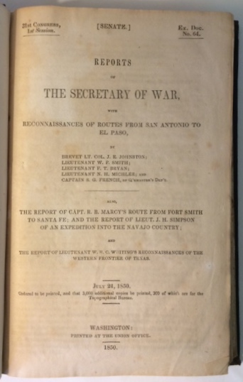
1850 WCB 184 Johnston, J[oseph] E[ccleston] (1807/2/3 – 1891/3/21); W[illiam] F[arrar] Smith (1824/2/17 – 1903/2/28) ; F[rancis] T[heodore] Bryan, (1823/4/11 – 1917/10/24); N[athaniel] H. Michler (1827/9/13 – 1881/7/17); S. G. French; R[andolph] B[arnes] Marcy, (1812/4/9 – 1887/11/22); J[ames] H[ervey] Simpson, (1813/3/9 – 1883/3/2); W[illiam] H[enry] C[hase] Whiting (1824/3/22 – 1865/3/10); 31st CONGRESS, | 1st Session. [SENATE.] Ex. Doc. | No. 64. [rule] REPORTS | OF | THE SECRETARY OF WAR, | WITH | RECONNAISSANCES OF ROUTES FROM SAN ANTONIO TO | EL PASO, | BY | BREVET LT. COL. J. E. JOHNSTON; | LIEUTENANT W. F. SMITH; | LIEUTENANT F. T. BRYAN; | LIEUTENANT N. H. MICHLER; AND | CAPTAIN S. G. FRENCH, OF Q’RMASTER’S DEP’T. [rule] ALSO, | THE REPORT OF CAPT. R. B. MARCY’S ROUTE FROM FORT SMITH | TO SANTA FE; AND THE REPORT OF LIEUT. J. H. SIMPSON | OF AN EXPEDITION INTO THE NAVAJO COUNTRY; | AND | THE REPORT OF LIEUTENANT W. H. C. WHITING’S RECONNAISSANCES OF THE | WESTERN FRONTIER OF TEXAS. [rule] JULY 24, 1850. | Ordered to be printed, and that 3,000 additional copies be printed, 300 of which are for the | Topographical Bureau. [rule] WASHINGTON: | PRINTED AT THE UNION OFFICE. [rule] 1850., First edition, 250 pp., octavo 23 x 15 cm., two folding maps, 72 plates (some colored), [Howes J170, WCB 184, Graff 2228; Meisel III, p. 113; Sabin 36377; MTW 641, 677]. Original brown embossed cloth. Top and bottom of spine frayed, corners bumped, light offsetting of text, but plates and maps are fine, over all very good+. $2000.
This volume contains reports by W.F. Smith, F.T. Bryan, N.H. Michler, S.G. French, R.B. Marcy and W. H. C. Whiting, in addition to the supremely important Navajo country report of J. H. Simpson. It is possibly the first book issued in America with color lithography. The colors are as bright as the day they were printed.


1850 WCB 192 Simpson, [James Hervey] (1813/3/9 – 1883/3/2); 31st CONGRESS, | 1st Session. [SENATE.] Ex. Doc. | No. 12. [rule] REPORT | FROM | THE SECRETARY OF WAR, | COMMUNICATING, | In compliance with a resolution of the Senate, the report and map of the | route from Fort Smith, Arkansas, to Santa Fe, New Mexico, made by | Lieutenant Simpson. [rule] JANUARY 14, 1850. | Ordered to be printed, and that 2,500 additional copies be printed, 500 of which are for the Topo- | graphical Bureau., Washington, 1850, 25 pp., four large folding maps, octavo 21.5 x 13.5 cm. [Howes S500; WCB 192; Graff 3790; Meisel III, p. 113; MTW 640]. Attractively bound in brown quarter morocco with gilt lettering and brown cloth. Fine. $1,100.


1850 WCB 192(note, including WCB 184) Simpson, [James Hervey] (1813/3/9 – 1883/3/2); R[andolph] B[arnes] Marcy (1812/4/9 – 1887/11/22); 31st CONGRESS, | 1st Session. [HO. OF REPS.] Ex. Doc. | No. 45. [rule] ROUTE FROM FORT SMITH TO SANTA FE. [rule] LETTER | FROM | THE SECRETARY OF WAR, | TRANSMITTING, | In compliance with a resolution of the House of the 6th February, a report |and map of Lieutenant Simpson, of the route from Fort Smith to Santa |Fe; also, a report on the same subject from Captain R. B. Marcy, | 5th infantry. [rule] FEBRUARY 21, 1850., Washington, 89 pp. , octavo 21.5 x 13.5 cm. one large folding map, two plates, [Howes S500; WCB 192 (note); Graff 3790; Meisel III, p. 113; MTW 640]. Beautifully rebound in green quarter morocco with gilt lettering and brown buckram. Fine. $900.


